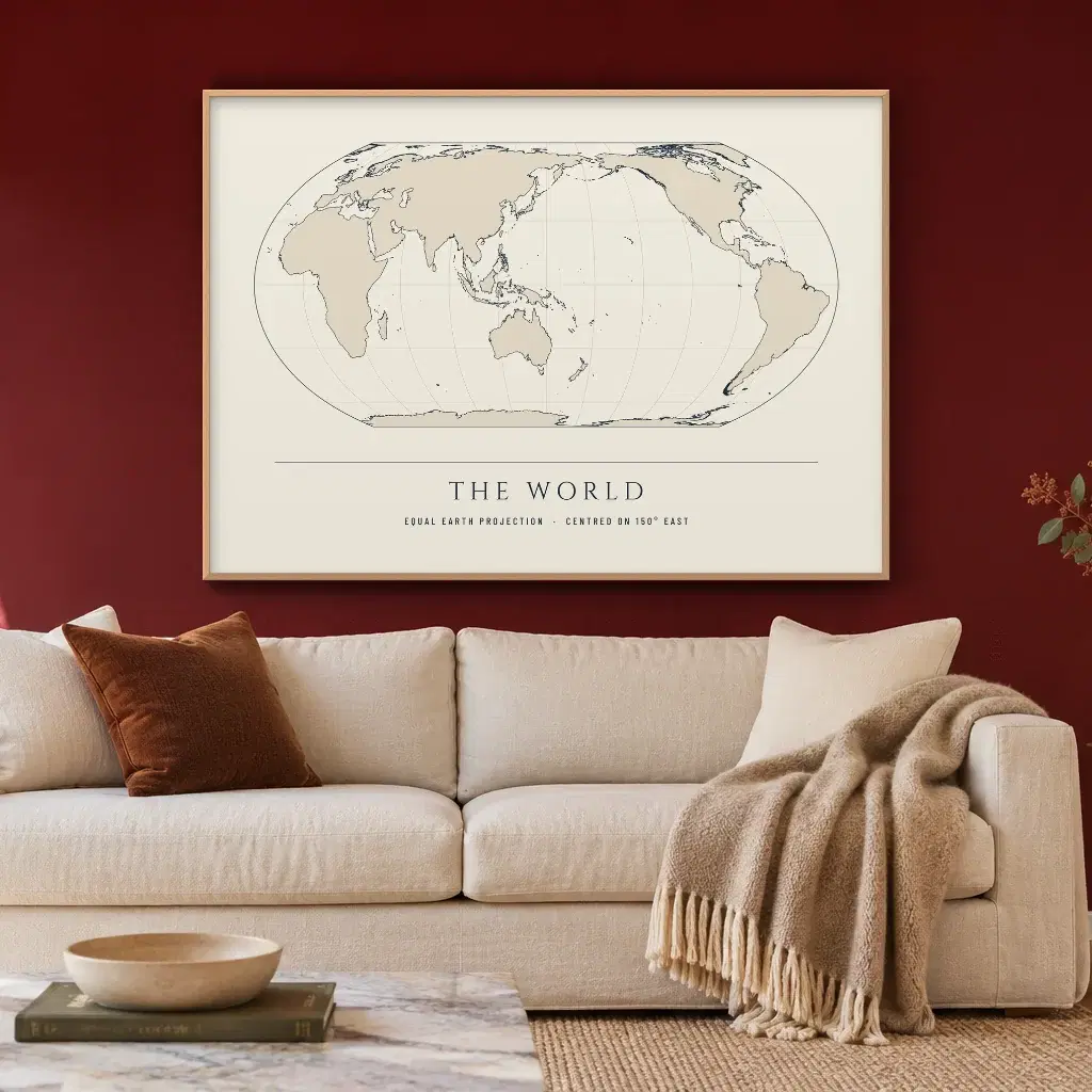
The World, Centred on AustraliaContour & CoastFramed from $109.00
Contour & Coast by Paperlust
Contour & Coast: World and Australia Map Prints
Every coastline on a Contour & Coast map print is the real one, plotted from published map data and printed in Australia.
Designed by our talented team in Melbourne using digital tools.
Style
Colour
Room
Orientation
Size
Format
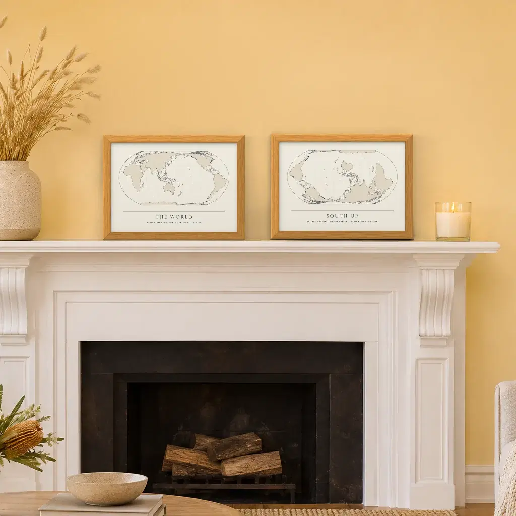
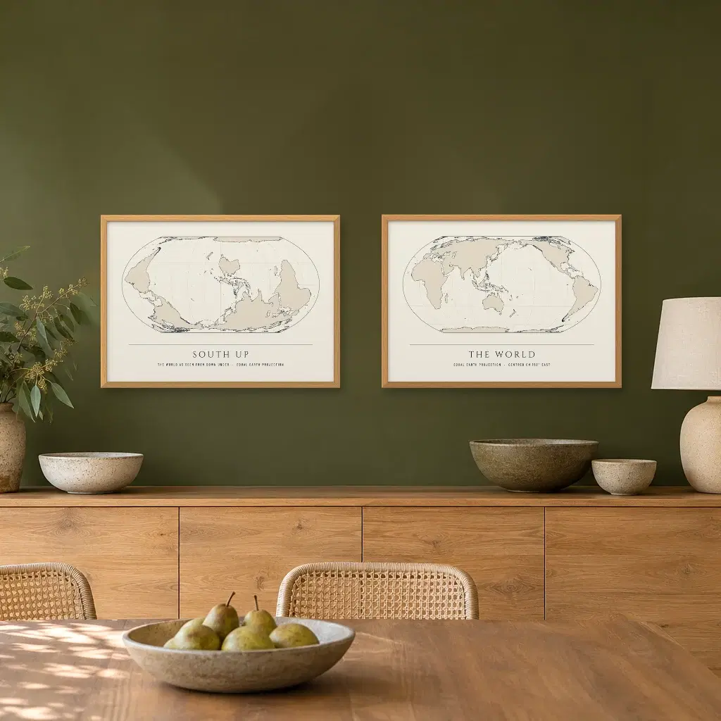
The World, Centred on AustraliaContour & CoastFramed from $109.00 South Up World MapContour & CoastFramed from $109.00
 Australia-Centred and South Up World Maps Pair2 printsFramed from $196.20 · save 10%
 The World, Centred on GreenwichContour & CoastFramed from $109.00
 Black and White World MapContour & CoastFramed from $109.00
 Painted World MapContour & CoastFramed from $109.00
 Kids World Map with AnimalsContour & CoastFramed from $109.00
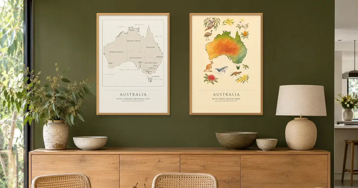
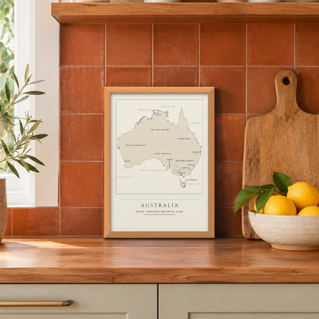
 Map of Australia, States and CapitalsContour & CoastFramed from $109.00
 Australian Animals MapContour & CoastFramed from $109.00
 Australia Map and Australian Animals Map Pair2 printsFramed from $196.20 · save 10%
 Painted Map of AustraliaContour & CoastFramed from $109.00
 Australia in ReliefContour & CoastFramed from $109.00
 Map of New South WalesContour & CoastFramed from $109.00
 Map of VictoriaContour & CoastFramed from $109.00
 Map of QueenslandContour & CoastFramed from $109.00
 Map of Western AustraliaContour & CoastFramed from $109.00
 Map of South AustraliaContour & CoastFramed from $109.00
 Map of TasmaniaContour & CoastFramed from $109.00
 Map of the Northern TerritoryContour & CoastFramed from $109.00
 The Ocean Floor MapContour & CoastFramed from $109.00
 Sydney Harbour MapContour & CoastFramed from $109.00
 Port Phillip Bay MapContour & CoastFramed from $109.00
 Sydney Harbour and Port Phillip Bay Maps Pair2 printsFramed from $196.20 · save 10%
Shop the look
Who makes Contour & Coast maps?
The maps are ours, made and sold under our own brand name, with no named maker attached. Our team in Melbourne designs each one with digital tools, and it is then printed, with a title and a subtitle set in a foot band beneath the map.
Where does the map data come from?
Natural Earth supplies the world coastlines. Geoscience Australia supplies coastline and border data for the country and its states, and for Port Phillip Bay. GEBCO 2020 provides heights and ocean depths, and OpenStreetMap provides Sydney Harbour. Each map's page credits the sources behind it, and where the licence asks, the credit also prints small on the piece.
What are the editions?
The range runs on five editions. Chart borrows the ruled border of a working sea chart. Line is a fine ink line on cream over a soft land tint. Mono is black line on white. Relief shades the land so the shape of the country stands out, and the fifth sets the real coastline back over soft colour for a painted look.
Is it painted or printed?
Printed. Each map is built digitally and printed, either as an archival giclee art print on 200gsm matte paper or on canvas where that format is offered. The edition with the painted look sets the true coastline over soft colour. Nothing is applied by hand at any stage.
Can I buy a pair?
Yes. Three pairs are sold together: the South Up World Map with The World, Centred on Australia; Australian Animals Map with Map of Australia, States and Capitals; and Port Phillip Bay Map with Sydney Harbour Map. Both pieces share one size and a single options set, and the pair saves 10% on buying them separately.
What does delivery cost?
Delivery Australia wide is $10 standard or $15 express per order, and you choose the service at checkout. The rate applies to the order as a whole rather than to each piece. Every Contour & Coast map is printed in Australia.
Frequently Asked Questions
Who makes Contour & Coast maps?
The maps are ours, made and sold under our own brand name, with no named maker attached. Our team in Melbourne designs each one with digital tools, and it is then printed, with a title and a subtitle set in a foot band beneath the map.
Where does the map data come from?
Natural Earth supplies the world coastlines. Geoscience Australia supplies coastline and border data for the country and its states, and for Port Phillip Bay. GEBCO 2020 provides heights and ocean depths, and OpenStreetMap provides Sydney Harbour. Each map's page credits the sources behind it, and where the licence asks, the credit also prints small on the piece.
What are the editions?
The range runs on five editions. Chart borrows the ruled border of a working sea chart. Line is a fine ink line on cream over a soft land tint. Mono is black line on white. Relief shades the land so the shape of the country stands out, and the fifth sets the real coastline back over soft colour for a painted look.
Is it painted or printed?
Printed. Each map is built digitally and printed, either as an archival giclee art print on 200gsm matte paper or on canvas where that format is offered. The edition with the painted look sets the true coastline over soft colour. Nothing is applied by hand at any stage.
Can I buy a pair?
Yes. Three pairs are sold together: the South Up World Map with The World, Centred on Australia; Australian Animals Map with Map of Australia, States and Capitals; and Port Phillip Bay Map with Sydney Harbour Map. Both pieces share one size and a single options set, and the pair saves 10% on buying them separately.
What does delivery cost?
Delivery Australia wide is $10 standard or $15 express per order, and you choose the service at checkout. The rate applies to the order as a whole rather than to each piece. Every Contour & Coast map is printed in Australia.
Learn More
Maps made from real data
No map line here is invented. World coastlines are plotted from Natural Earth, the Australian pieces work from Geoscience Australia's coastline and border files, GEBCO 2020 supplies heights and ocean depths, and OpenStreetMap sits behind Sydney Harbour.
Projection shapes the view as much as the source does. World maps use Equal Earth, an equal-area projection that keeps each landmass in proportion to its real area, so Greenland stops looking larger than Africa. The Australian maps use Albers with standard parallels set for the country, and the world views carry coastlines only, with no country borders.
The editions
Editions run across our map prints, and each sets a different mood. Chart takes its cue from working sea charts, its border ruled at the edge, and suits a harbour map above a desk. Line is a fine ink line on cream over a soft land tint, quiet enough for a hallway. Mono pulls colour out altogether, black line on white, and settles easily against the rest of our wall art range. One edition works in a painted look, soft colour tucked under the real coastline, which makes it the gentler choice for a kitchen or a child's room. Relief shades the land as though lit from one side, so hills and ranges step forward.
World maps, state maps and harbour charts
Several world map views are available, among them The World, Centred on Greenwich and the South Up World Map, which suits anyone who has noticed that many English speakers link north with up and south with down. Closer in, Map of Australia, States and Capitals names each capital, Map of Queensland and Map of Victoria hold a single state apiece, and Australia in Relief does the same work with terrain. The Ocean Floor Map turns the view to the sea bed, while Sydney Harbour Map and Port Phillip Bay Map work at the scale of a city and its bay. The state maps can hang side by side, an easy run of map wall art along a hall.
Every piece comes as an art print, a framed print or a canvas, and canvas runs only on the painted look pieces and some antique maps. An art print is unframed giclee on 200gsm archival matte paper. A framed print sits in a thin 20 mm frame, oak look, black or white, with perspex at the front rather than glass, and arrives ready to hang. World maps open on 50 x 70 cm framed, while the maps of Australia and its states, and the harbour charts, open on A3 framed. A size appears only where the whole map, its type and its border fit the shape and the file holds the detail, and the preview shows the crop that prints. Some pieces sell as a matched pair, one size and one set of options covering both, and a pair saves 10% on buying the two separately. We also carry antique maps from named library collections, sold under the mapmaker's name.
The data credits
The licences behind this data ask for set wording, so each map's page names every source behind it, and the lines below appear in small type on the pieces that use them.
- Map data © Commonwealth of Australia (Geoscience Australia) 2026, CC BY 4.0
- Map data © OpenStreetMap contributors, openstreetmap.org/copyright (Sydney Harbour Map)
How it is made
Designed by our talented team in Melbourne using digital tools.
Printed in Australia. Delivery is $10 standard or $15 express per order.